Category Archives: Flower buds

2013 Meeting Dates

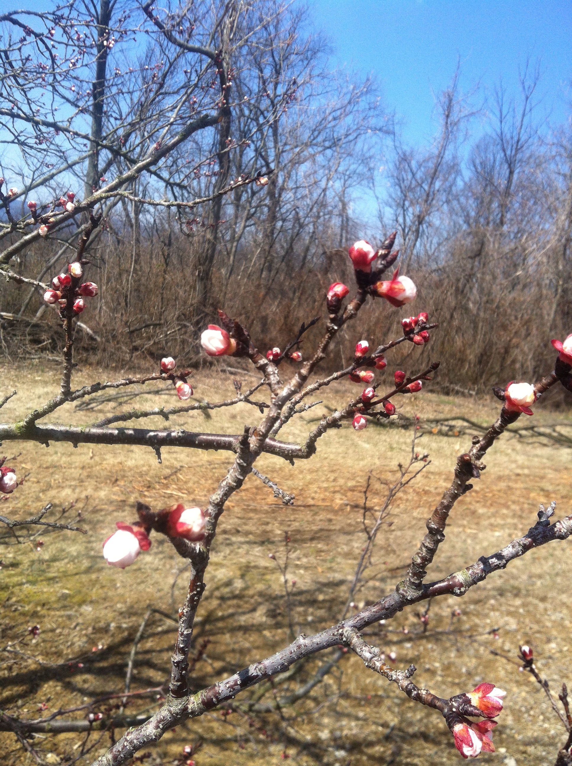
Apricot flowers at "popcorn" stage.

Well, it’s hard to believe it given the cool temperatures that continue to prevail, but our Spring meetings start this week with an In-Orchard meeting at Crown Orchards on Tuesday starting at 11AM and an In-Depth meeting at the Alson H. Smith, Jr. AREC on Thursday evening starting at 7PM. Our first Rappahannock County meeting will be next Wednesday (April 10) at Jenkins Orchard starting at 11AM.

All tree-fruit meeting dates, times, locations, and directions can be found at the new Tree-Fruit Extension and Outreach Website by clicking on the Upcoming programs & events link.

To ensure that you don’t miss future announcements, please be sure to sign up for the Virginia Tech tree-fruit email delivery service by entering your email in the “Subscribe to commercial tree fruit updates” box on the Tree-Fruit Extension and Outreach Website.

The meetings are focused on commercial tree-fruit production. However, meetings are open to all, regardless of age, color, disability, gender, national origin, political affiliation, race, religion, sexual orientation, or veteran status. Virginia Cooperative Extension is an equal opportunity/affirmative action employer.

MaluSim Carbohydrate Model for April 16

Earlier today, I ran the MaluSim Carbohydrate Model for Winchester. I used actual data from the meteorological station located at the AREC and forecast data from www.intellicast.com and the National Weather Service (NWS). The two forecasts produced reasonably similar carbohydrate balance simulations, so I just show the simulation using the intellicast forecast in the pdf. Also, intellicast provides ten-day forecasts for both temperature and cloud cover, while the NWS only provides a seven-day temperature forecast, with only five-day forecasts for cloud cover data.

This brings us to an important point that I’ve discussed before (and others have discussed about other weather-forecast dependent models), which is that the predictions of future carbohydrate balance are only as good as the weather forecast data that are used as inputs. Many weather forecasts are fairly reliable for three to five days and then lose reliability the further into the future they try to predict weather conditions.  The take home message is that the conditions may change by the time we get to the 10 mm fruitlet size on many cultivars. I will continue to watch the weather and will try to run another MaluSim simulation towards the end of this week.

Nonetheless, the model is showing that there is not going to be a very severe carbohydrate surplus nor deficit over the next ten days. This means that you can expect an average or “normal” response from your chemical thinners. At the AREC, some cultivars will probably reach 10 mm this weekend or early next week. Areas to the south may already be at or beyond that size.

By now, you should be able to assess damage from the March 27 freeze. In fact, the damaged fruit has probably already fallen off the tree. If not, damaged fruit can be identified as having a red stem and being easily detached from the cluster. There seems to be a fairly large difference in damage between just a five or 10-foot change in elevation. In some blocks, this might mean using different rates on different rows, or turning on or off the sprayer as you drive up and down hills.

April 12 Breakfast Meeting Slides — Winchester

I’ve uploaded the slides that I presented at the Breakfast Meeting at the AREC on April 12. The slides include the MaluSim carbohydrate model that I ran for Winchester on April 11. The model is dependent upon local weather data, so it may have minimal relevance for conditions in other parts of the state. The model is best used to predict the activity of thinning chemicals immediately after they have been applied. In other words, the future prediction of carbohydrate balance is more important than what the model shows for the past carbohydrate balance. I’ll run the model again early next week as we get closer to the 8-12 mm fruitlet size.

I also show data for fruitlet sizes at the AREC, and rainfall to date. Needless to say, the soil is already very dry and newly planted trees should be irrigated as soon as possible to reduce transplant shock. In Winchester, there’s only a minimal chance of rain predicted for the next 10 days.

Frost Damage

At our lab in Winchester, we got down to 28F for 2 hours this morning between 6 and 8 AM. I’m seeing damage to king bloom in early blooming apples, but side blooms look like they’ll fair much better. However, I’ve been hearing reports down to 25F in some orchards, with much worse damage. Sweet cherries were in full bloom, and many petals are showing damage. Peaches were past petal fall, and the trees in the lowest area on our farm are probably going to loose some fruit.

It’s going to be a difficult thinning year if we loss a large percent of the king bloom…Unfortunately, we still have about a month where we can potentially have another frost…

 Sweet cherries–more damage on the tops of the branches, than on the bottom, where there still might be some viable flowers.


Frost damage to king and some side bloom in Pink Lady. This tree was at the lowest area of the block. Unopened side bloom appeared to have minimal damage, but it’s still early to quantify the damage.

There appeared to be less damage to this Red Delicious flower with the king bloom open and side bloom still closed.

National Weather Service Issues Freeze Alert

The National Weather Service is now predicting temperatures to go to at least 29F in many of the fruit growing regions in Virginia early Tuesday morning. If you have frost protection machines or burners, spend some time tomorrow to make sure they are operational and properly placed throughout the orchard.

See my previous post for the critical temperatures at which damage occurs for the main tree-fruit crops.

Early bloom and potential frost damage

We are easily three, and maybe four weeks ahead of “average” bloom dates in the Winchester area. Apples flower buds are ranging from tight cluster (Fuji) to open cluster (Red Delicious) to about 10% bloom open (Pink Lady). Peaches are at full bloom to petal fall. Cherries are at first bloom.

Pink Lady–10% bloom open.

Sweet Breeze peach — full bloom

Sweetheart/G.12 sweet cherry — full bloom

The National Weather Service is forecasting a potential low of 34F on Monday night (Tuesday morning) and a potential low of 38F on Tuesday night (Wednesday morning). If you have areas that are known frost pockets (low areas with minimal or no air drainage) in your orchard, the temperatures may be closer to the freezing point.

However, these temperatures should be above the critical temperature for damage. Apples in tight cluster to first bloom should be able to withstand temperatures down to 27 or 28F until there is a 10% kill, and down to 21F for tight cluster and 24-25F for pink to full bloom until there is a 90% kill.

Peaches in full bloom to petal fall can withstand 27-28F until there is a 10% kill, and down to 24-25F until there is a 90% kill.

Cherries in first to full bloom can withstand 28F until there is a 10% kill, and down to 25F until there is a 90% kill.

Pears in first to full bloom can withstand 27-28F until there is a 10% kill, and down to 23-24F until there is a 90% kill.

Nonetheless, it’s going to be a long time until we get through the last potential frost occurrence. The NOAA cites April 23 as the day beyond which we have only a 10% chance of having a temperature below 28F. You can look up other locations, temperatures , and percent chances for a frost occurrence here: NOAA Freeze/Frost Occurrence Data.

Here are pdf links for the Washington State University fact sheets on the critical temperatures for flower buds:

Michigan State University has adapted the WSU critical temperature fact sheets into this easy to read fact sheet.